Works offline
Offline essentials
ضروری معلوماتEmergency numbers, altitude sickness, mountain driving and more. Saved on your phone once you open it.
Save the cheat sheet
One image with emergency numbers, altitude steps and mobile networks. Save it to your phone's gallery before you go.
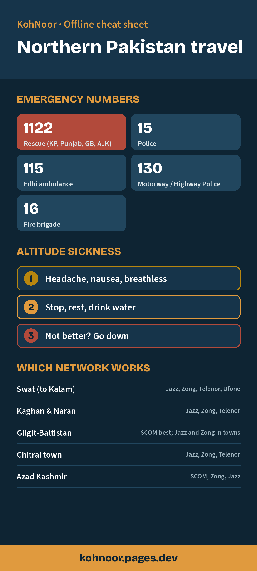
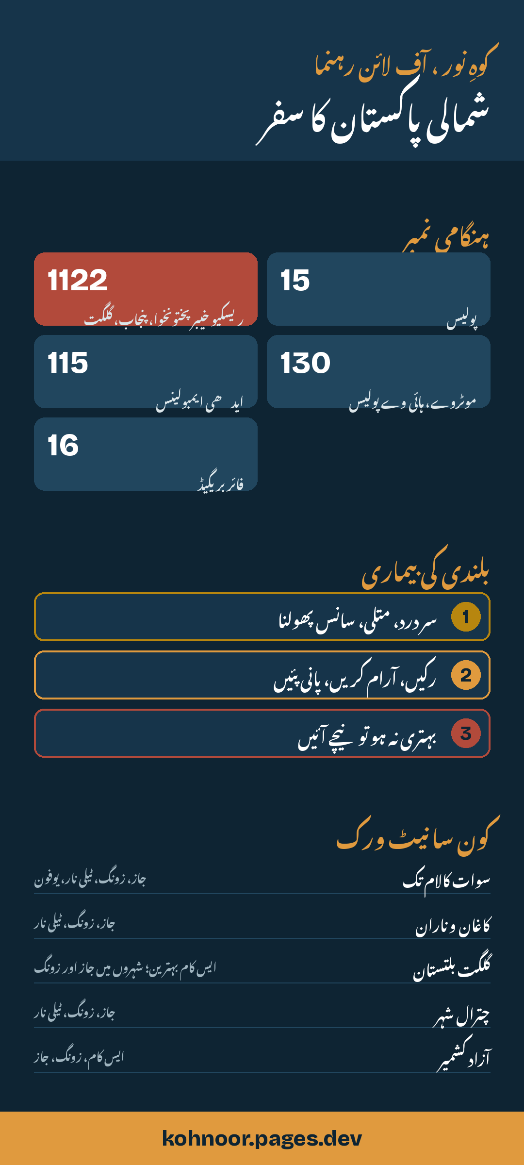
Emergency numbers
Roads & passes this month
Babusar Pass
Kaghan to Chilas · 4,170 mKhunjerab Pass
Hunza to China border · 4,690 mDeosai Plains road
Skardu to Astore · 4,100 mShandur Pass
Chitral to Ghizer · 3,700 mLowari Tunnel
Dir to Chitral, open all year · 2,400 mKarakoram Highway
Open all year; landslides after rain · 1,500 mNaran–Kaghan road beyond Naran
Snow closes it in winter · 2,400 mKalam–Mahodand track
Jeep track · 2,865 mSeasonal guide, not live status. Before you travel, confirm with Motorway/Highway Police on 130 or local police.
Altitude sickness
1
Headache, nausea, breathless
Common above about 2,500 m, especially on day one.
2
Stop, rest, drink water
Stay at the same height. Do not climb higher.
3
Not better? Go down
Dropping 300–500 m is the best treatment.
- Above about 2,500 m some people get altitude sickness: headache, nausea, breathlessness, poor sleep.
- Climb slowly. Do not go from Islamabad to Babusar, Khunjerab or Deosai in one day if you can avoid it.
- Drink plenty of water and avoid heavy exercise on the first day high up.
- If symptoms get worse, go down. Going lower is the best treatment. Seek medical help for confusion or severe breathlessness.
Mountain driving
- Start early. Mountain roads are safest in daylight.
- After heavy rain, landslides are common. Ask locals and police before crossing.
- Check engine, brakes and tyres before you go; workshops are far apart.
- On narrow roads, the vehicle going uphill usually has right of way.
- In snow, carry chains or use a 4x4.
Packing list
CNIC / passport
Cash
Warm jacket
Power bank
First aid
Sun care
Water
Rubbish bag
- CNIC (and passport for foreigners) plus photocopies
- Cash: ATMs thin out after the main towns
- Warm jacket, even in July
- Power bank and car charger
- Basic medicines and a first-aid kit
- Sunscreen, sunglasses, cap
- Water bottle and snacks for long drives
- Rubbish bag: carry your litter back
Install KohNoor on your phone
Android (Chrome)
- Open kohnoor.peakheron.com in Chrome
- Tap the ⋮ menu at the top right
- Choose “Add to Home screen”
iPhone (Safari)
- Open the site in Safari
- Tap the Share button at the bottom
- Choose “Add to Home Screen”
Which mobile network works
| Area | Usually works |
|---|---|
| Swat (to Kalam) | Jazz, Zong, Telenor, Ufone |
| Kaghan & Naran | Jazz, Zong, Telenor |
| Gilgit-Baltistan | SCOM best; Jazz and Zong in towns |
| Chitral town | Jazz, Zong, Telenor |
| Azad Kashmir | SCOM, Zong, Jazz |
Permits & checkposts
- Carry your CNIC at all times; checkposts are common on the KKH and near the Line of Control.
- Foreign visitors should carry their passport and visa; some areas near borders need a No Objection Certificate (NOC). Check with a registered tour operator.
- Trekking to K2 base camp and some restricted peaks needs permits and a licensed operator.
Respect & etiquette
- Dress modestly, especially in villages.
- Ask before photographing people, and never photograph women without permission.
- Do not photograph military or security posts.
- Leave sacred places, graves and Kalash shrines undisturbed.
Travel responsibly
- Carry your rubbish back; many valleys have no waste collection.
- Use local guides, jeeps and guesthouses so money stays in the valley.
- Do not swim in glacier rivers: they are fast and freezing.
- Never feed or approach wildlife, especially bears in Deosai.